The Snipatuit Pond, Wareham, Plympton, and Plymouth Quadrangles
Photographic Essay
of
Snipatuit Pond, Wareham, Plympton,
and Plymouth Quadrangles
Weweantic River, Massachusetts
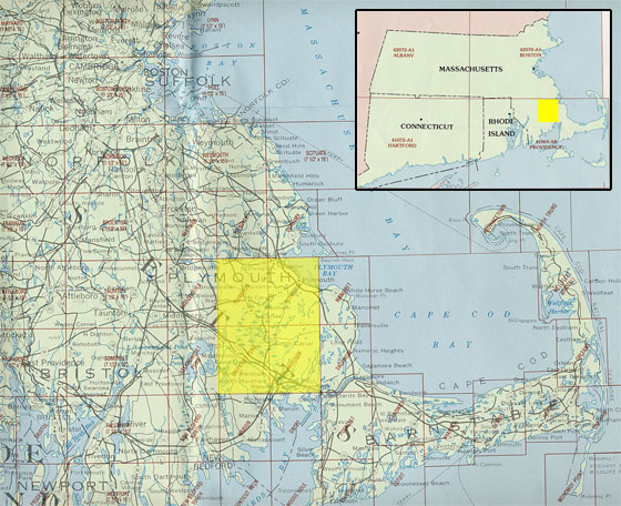
The photographic essay focuses on Weweantic River, Massachusetts (Figure 1). Photographs of selected wetland and upland locations are digital camera images taken by the WETMAAP Development Team, October 2002 (Figure 2 and Figure 3).
The photographic essay is for use with a series of aerial photographs, topographic maps, wetland and upland habitat maps, and selected materials that assist in the identification of changes in wetland and upland habitats surrounding the Weweantic River, Massachusetts.
The photographic essay identifies habitat changes within the area resulting from changes in land use, especially cranberry farming, and urban, commercial, and recreational development. Emphasis is on comparing ground level photography with maps and aerial photography and aids in wetland and upland interpretation for the area.
Comparing ground level photography with maps and aerial photography aids in wetland and upland interpretation for the area. The essay shows representative examples of conversion of natural bogs for cranberry production.
Figure 1: Proximal
Location
The Snipatuit Pond, Wareham, Plympton, and
Plymouth Quadrangles
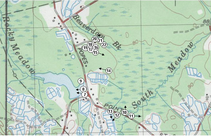
Figure 2: Weweantic Photo
Essay
Ground Photograph Locations With
Line-of-Site
Plate numbers correspond with circled numbers on the reduced
sections (Weweantic River Site) of the Snipatuit Pond, Wareham, Plympton, and
Plymouth quadrangles. Arrows indicate direction of line-of-sight.
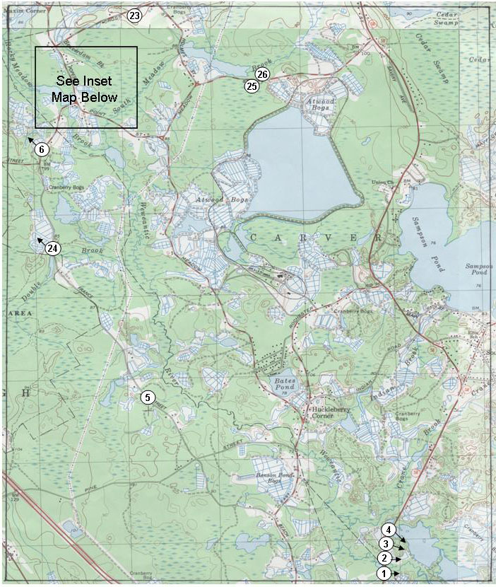
Figure 3: Weweantic Photo
Essay
Ground Photograph Locations With
Line-of-Site
Plate numbers correspond with circled numbers on the reduced
sections (Weweantic River Site) of the Snipatuit Pond, Wareham, Plympton, and
Plymouth quadrangles. Arrows indicate direction of line-of-sight.