Quadrangle
Photographic Essay
of
Texas City/Virginia Point,
Texas
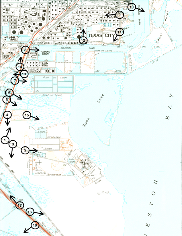
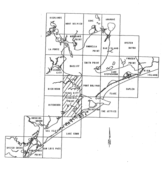
The focal point of the essay is the Virginia Point Quadrangle and Texas City, Texas (Figure 3.1). Photographs of selected wetland sites are from 35mm slides taken by the WETMAAP Development Team August 27, 1999 (Figure 3.2).
The photographic essay is for use with a series of aerial photography, topographic maps, National Wetland Inventory maps, and selected materials on changes of wetlands for Virginia Point and Texas City of the Galveston Bay area.
The photographic essay has a dual purpose. First, the essay identifies wetlands and potential issues surrounding Galveston Bay wetlands. Comparing ground level photography with maps and aerial photography aids in wetland interpretation.
Second, the essay shows representative examples of wetland categories -- open water, marsh, and upland scrub-shrub -- that illustrate variations among wetland habitat types.
The Virginia Point Quadrangle and Texas City are well-known for their proximity to the off-shore oil industry, which results in increased industrialization (Amoco Refinery) and urbanization. Federal and state regulations affect habitats. Specific habitats affected by human and natural changes over time include emergent marsh, open water, and agriculture/range.
Figure 1: Proximal Location
Quadrangle
Figure 2: Texas City/Virginia Point Photo Essay
Plate numbers correspond with circled numbers on the reduced section (Texas City/Virginia Point site) of the Texas City/Virginia Point quadrangle. Arrows indicate directions of line-of-sight.