Photographic Essay
of
Tempisque and Talolinga Quadrangles
Rio Tempisque, Costa Rica
The photographic essay focuses on the area around Rio Tempisque, Costa Rica. Photographs of selected wetland and upland locations are prints and digital camera images taken by the WETMAAP Development Team, August 16, 2003 (Figure 3.1).
The photographic essay is for use with a series of aerial photographs, topographic maps, wetland and upland habitat maps, and selected materials that assist in the identification of changes of wetland and upland habitats for the Rio Tempisque area.
The photographic essay identifies habitat changes within the area resulting from natural succession and changes in hydrology. Comparing ground level photography with maps and aerial photography aids in wetland and upland interpretation for the area. The essay shows representative examples of freshwater emergent wetlands, fresh open water, forested wetlands, wetland scrub-shrub, upland forest, upland scrub-shrub, urban, and agriculture.
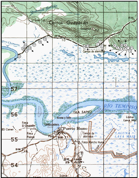
Figure 3.1: Rio Tempisque Photo
Essay
Ground Photograph Locations
Plate numbers correspond with circled numbers on the reduced section (Rio Tempisque site) of the Tempisque and Talolinga quadrangles. Arrows indicate directions of line-of-sight.