Photographic Essay
of the
Red River Site Louisiana
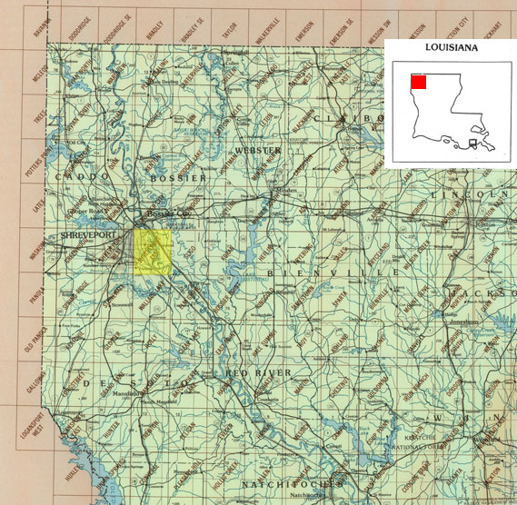
The photographic essay focuses on the Red River at Shreveport, Louisiana
(Figure 3.1). Photographs of selected wetland and floodplain locations are
digital camera images taken by the WETMAAP Development Team, August 2004 and
June 2005 (Figure 3.2).
The photographic essay is for use with a series of aerial photographs, topographic maps, wetland and upland habitat maps, and selected materials that assist in the identification of changes of wetland and floodplain habitats.
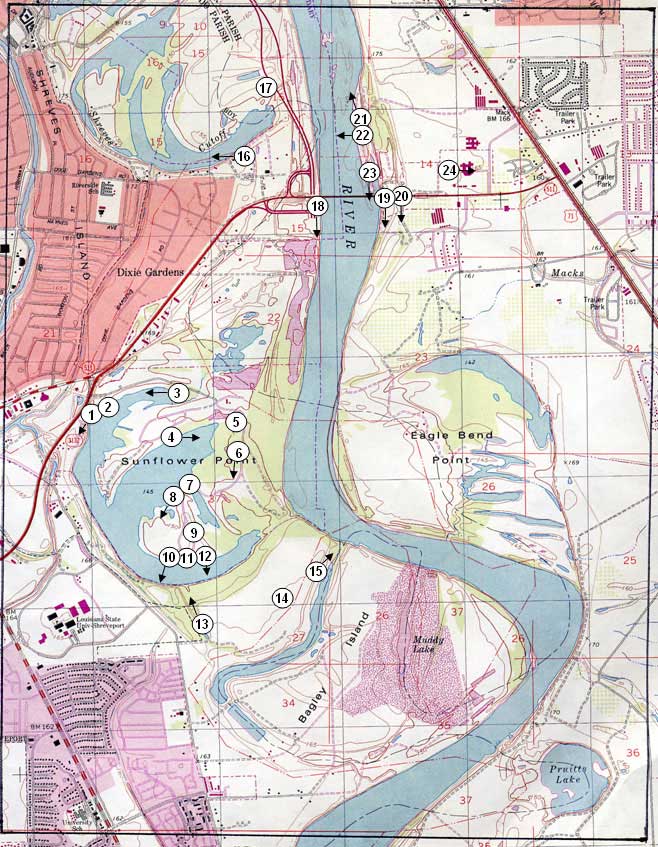
The photographic essay identifies habitat changes within the floodplain of the Red River near Sunflower Point. The focus is on changes in floodplain management, and development meander river features including cutoff, oxbow lakes, and meander scars. Emphasis is on comparing ground level photography with maps and aerial and satellite imagery that aid in wetland and floodplain interpretation for the area. The essay shows representative examples of fresh open water-lakes and channels, forested wetland, wetland scrub-shrub, upland agricultural, upland range, and urban.
Figure 3.1: Proximal Location
The Red River study site Shreveport East Quadrangle
Figure 3.2: Red River Photo Essay
Ground Photograph Locations With Line- of- Sight
Plate numbers correspond with circled numbers on the reduced section (Red River site) of the Shreveport East quadrangles. Arrows indicate directions of line-of-sight.