Photographic Essay
of the
Lake Pontchartrain Basin
Northshore
St Tammany Parish, Louisiana
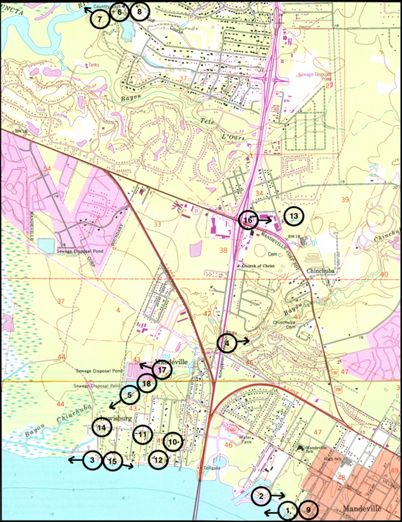
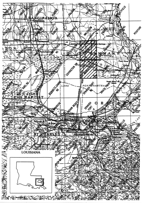
The focal point of the essay is the Covington/Mandeville Quadrangle of the Lake Pontchartrain Basin (Figure 1). Photographs of selected wetland sites are from 35mm slides taken by the WETMAAP Development Team, February 1999 (Figure 2).
The photographic essay is for use with a series of aerial photography, topographic maps, National Wetland Inventory maps, and selected materials on the impact of urbanization and wetland and upland habitat changes along the northshore of Lake Pontchartrain Basin.
The photographic essay has a dual purpose. First, the essay identifies some striking habitiat changes within the area. The changes in freshwater and saltwater regimes has affected forested wetlands, scrub-shrub, and marsh. Comparing ground level photography with maps and aerial photography aids in wetland interpretation.
Second, the essay shows representative examples of wetland categories -- open water, marsh, flats and beaches, wetland forests, agriculture/range, and urban areas -- that illustrate variations among wetland habitat types.
Since 1956 and based on 34 years of documentation, Coastal Louisiana has experienced significant changes in wetland loss and habitat change. Human activity, specifically dredging and spoil disposal and port activities associated with navigation and industrial development, and agricultural activity throughout the Lake Pontchartrain Basin accounts for slightly less than 50% of the wetland loss and habitat change. The remaining 50% is a result of natural succession, salinity changes, shoreline erosion, and subsidence.
Figure 1: Proximal Location
The Northshore study site Covington/Mandeville Quadrangle
Figure 2: Northshore Photo Essay
Ground Photograph Locations With Line of Sight
Plate numbers correspond with circled numbers on the reduced section (Northshore site) of the Covington and Mandeville quadrangles. Arrows indicate directions of line-of-sight.