Photographic Essay
of the
Mobile Bay Delta Area
Bridgehead Quadrangle
Mobile Bay, Alabama
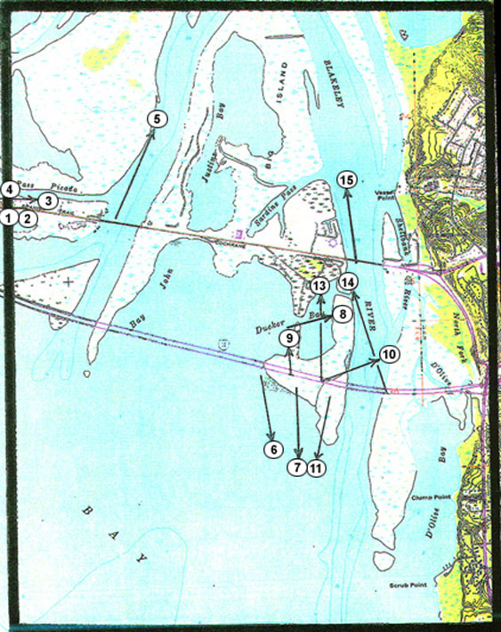
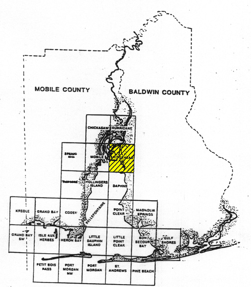
The focal point of the essay is the Bridgehead Quadrangle area of Mobile Bay (figure 1). Photographs of selected wetland sites are from 35mm slides taken by the WETMAAP Development Team July 28, 1997 (figure 2).
The photographic essay is for use with a series of aerial photography, topographic maps, National Wetland Inventory maps, and selected materials on the impact of fresh water inflow and wetland and upland habitat changes in Mobile Bay.
Mobile Bay has experienced significant changes in wetland loss and habitat change. Human activity, specifically changes in wetland loss and habitat change. Human activity, specifically dredging and spoil disposal and port activities associated with navigation and industrial development, and agricultural activity throughout the Mobile-Alabama River Basins account for slightly less than 50% of the wetland loss and habitat change. The remaining 50% is a result of natural succession, salinity changes, shoreline erosion, and subsidence.
The photographic essay has a dual purpose. First, the essay identifies some striking changes of flats, beaches and bars within the area. There are some minimal changes in scrub-shrub and forest areas and urban development along the Causeways. Comparing ground level photography with map and selected aerial photography aids in wetland interpretation.
Second, the essay shows representative examples of ten wetland categories -- open water, marsh, flats and beaches, wetland forests, upland ranges, upland agriculture, urban, and urban wetland areas -- that illustrate variations among wetland habitat types.
Figure 1: Proximal Location
The Mobile Bay Study Site Bridgehead Quadrangle
Figure 2: Mobile Bay Photo Essay
Ground Photograph Locations With Line of Sight
Plate numbers coorespond with circled numbers on the reduced section (Mobile Bay site) of the Bridgehead quadrangle. Arrows indicate directions of line-of-sight.