Photographic Essay
of the
La Parguera Site Puerto Rico
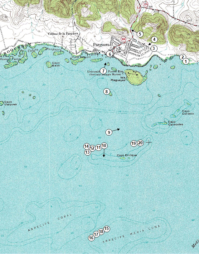
The photographic essay focuses on an area of La Parguera, Puerto Rico. Photographs of selected wetlands locations are digital camera images taken by the WETMAAP/CNL World Programs Development Team September 22 and 23, 2009 (Fig. 3.1).
The photographic essay is for use with a series of aerial photographs, topographic maps, wetland and upland land cover maps, and selected materials that assist in the identification of changes of wetland habitats.
The site focus is on coral reefs, coastlines, and mangroves associated with coastal areas. The photographic essay identifies land cover and habitat changes of a portion of the La Parguera area. Emphasis is on comparing ground level photography with maps and aerial imagery that aid in wetland interpretation for the area.
Figure 3.1: La Parguera Photo Essay
Ground Photograph Locations With Line- of- Sight
Plate numbers correspond with circled numbers on the reduced section (La Parguera site) of the Parguera quadrangles. Arrows indicate directions of line-of-sight.