Photographic Essay
of
Golden Meadow
The photographic essay focuses on the Golden Meadow area of the Barataria-Terrebonne National Estuary (Figure 3.1). Photographs of selected wetland and upland locations are from 35mm slides, 5” x 7” photographs, and digital camera images by the WETMAAP Development Team, January 30, 2000 (Figure 3.2).
The photographic essay is for use with a series of aerial
photographs, topographic maps, wetland and upland habitat maps, and selected materials
that assist in the identification of changes of wetland and upland habitats and
human activities along Bayou Lafourche.
The photographic essay has a dual purpose. First, the essay identifies striking habitat
changes within the area. The changes in
freshwater and saltwater regimes, oil and gas field development, and hurricane protection
levee construction has affected forested wetlands, scrub-shrub, marsh, open water, and
human occupation. Comparing ground level
photography with maps and aerial photography aids in wetland and upland interpretation for
the area. Second, the essay shows
representative examples of wetland and upland categories -- open water, marsh, wetland
forests, scrub-shrub, agriculture/range, and urban areas -- that illustrate variations
among the wetland and upland habitat types.
Based on 34 years of documentation, from 1956 to 1988/90, Coastal Louisiana has experienced significant changes in wetland loss and habitat change. The direct impacts of human activity, specifically dredging, oil and gas development, levee construction, spoil disposal, port activities, agricultural activity, and urbanization throughout the Barataria-Terrebonne Basin accounts for slightly less than 50% of wetland loss and habitat change. The remaining 50 % of the direct impacts of wetland loss and habitat change is the result of natural succession, salinity changes, shoreline erosion, and subsidence.
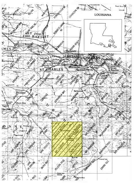
Figure 1: Proximal Location
The Golden Meadow/Golden Meadow Farms/Bay
Courant/Mink Bayou Quadrangle
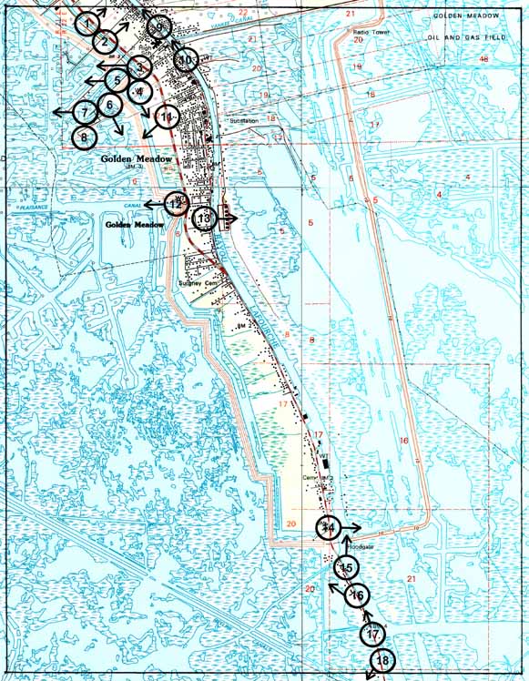
Figure 3.2: Golden Meadow Photo Essay
Ground Photograph Locations With Line of Sight
Plate numbers correspond with circled numbers on the reduced section (Golden Meadow site) of the Golden Meadow/Golden Meadow Farms/Bay Courant/Mink Bayou quadrangle. Arrows indicate directions of line-of-sight.