Photographic Essay
of the
False River Site Louisiana
The photographic essay focuses on False River in Louisiana
(Figure 3.1). Photographs of selected wetland and floodplain locations are
digital camera images taken by the WETMAAP Development Team, August 2007 (Figure 3.2).
The photographic essay is for use with a series of aerial photographs, topographic maps, wetland and upland habitat maps, and selected materials that assist in the identification of changes of wetland and floodplain habitats.
The photographic essay identifies habitat changes within the floodplain of the False River. The essay shows representative examples of fresh open water-lakes and channels, forested wetland, wetland scrub-shrub, upland agricultural, upland range, and urban.
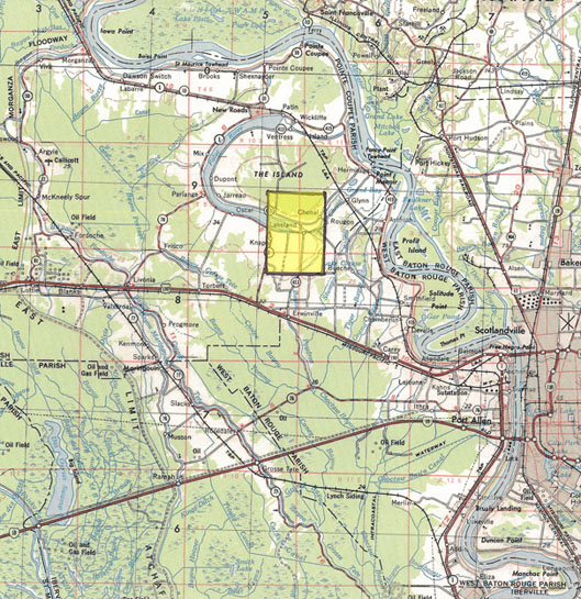
Figure 3.1: Proximal Location
The False River study site New Roads Quadrangle
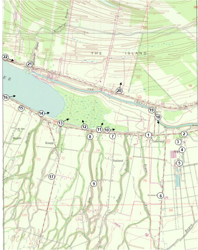
Figure 3.2: False River Photo Essay
Ground Photograph Locations With Line- of- Sight
Plate numbers correspond with circled numbers on the reduced section
(Louisiana site) of the New Roads and Erwinville quadrangles. Arrows indicate directions of
line-of-sight.