Photographic Essay
of the
Crescent Lake Wildlife Refuge,
Nebraska
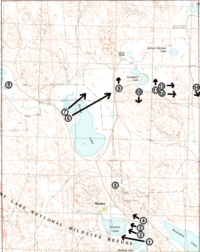
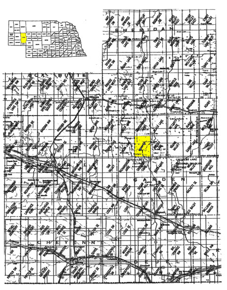
The focal point of the essay is the Mumper Quadrangle, Crescent Lake National Wildlife Refuge, Nebraska (Figure 1). Photographs of selected wetland sites are from 35mm slides taken by the WETMAAP Development Team October 1998 and June 1999 (Figure 2).
The photographic essay is for use with a series of aerial photography, topographic maps, National Wetland Inventory maps, and selected materials on changes of wetlands within the Nebraska Sandhills.
The photographic essay has a dual purpose. First, the essay identifies wetlands and potential issues surrounding Nebraska Sandhills wetlands. Comparing ground level photography with maps and aerial photography aids in wetland interpretation.
Second, the essay shows representative examples of wetland categories -- open water, marsh, forested wetlands, and agriculture/range -- that illustrate variations among wetland habitat types.
The Nebraska Sandhills are well-know for its wildlife, especially birds. Human activities including ranching, agriculture, and federal land management affect habitats. Specific habitats affected by human and natural changes over time include grasslands, waterfowl habitat in marsh areas of sandhill water bodies, and wetland forests.
Figure 1: PROXIMAL LOCATION
The Crescent Lake Study Site Mumper Quadrangle
Figure 2: Crescent Lake Photo Essay
Ground Photograph Locations With Line of Sight
Plate numbers correspond with circled numbers on the reduced section (Crescent Lake site) of the Mumper quadrangle. Arrows indicate directions of line-of-sight.