Photographic Essay
of
Columbia Bottom, Missouri
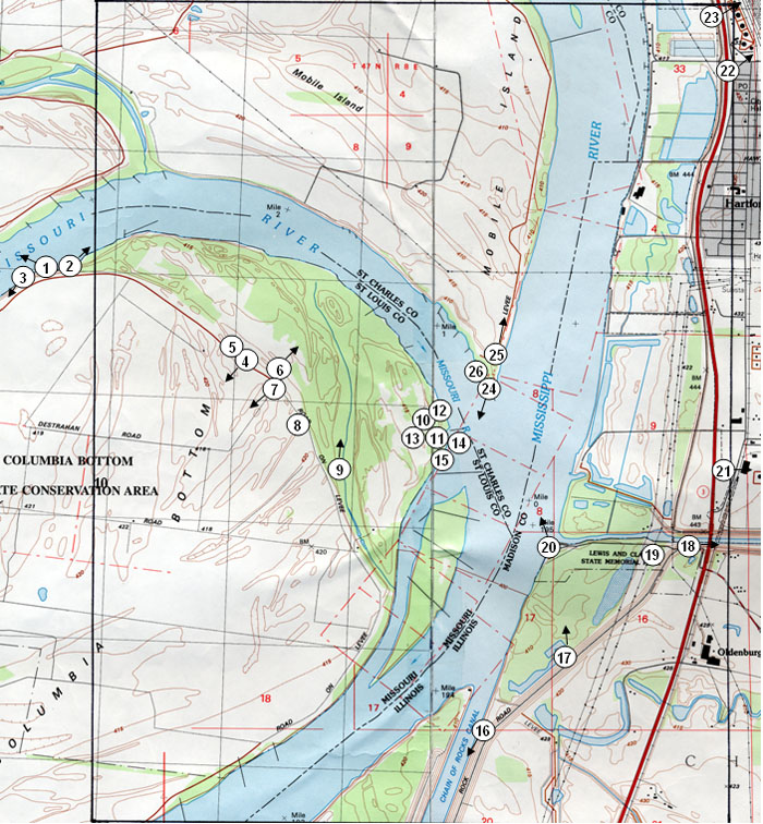
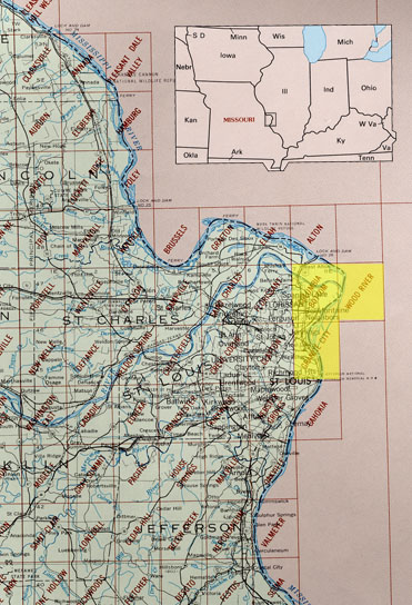
The photographic essay focuses on Columbia Bottom, St. Louis Missouri (Figure 3.1). Photographs of selected wetland and floodplain locations are digital camera images taken by the WETMAAP Development Team, October, 2004 (Figure 3.2).
The photographic essay is for use with a series of aerial photographs, topographic maps, wetland and upland habitat maps, and selected materials that assist in the identification of changes of wetland and floodplain habitats.
The photographic essay identifies habitat changes within the floodplain of the confluence of the Mississippi and the Missouri Rivers. The focus is on changes in floodplain management, agriculture, and development. Emphasis is on comparing ground level photography with maps and aerial photography that aid in wetland and floodplain interpretation for the area. The essay shows representative examples of fresh open water, fresh marsh, forested wetland, wetland scrub-shrub, upland agricultural, and urban.
Figure 3.1: Proximal
Location
Figure 3.2: Columbia Bottom Photo
Essay
Ground Photograph Locations With
Line-of-Site
Plate numbers correspond with circled numbers on the reduced
sections (Columbia Bottom Site). Arrows indicate direction of line-of-sight.