Photographic Essay
of
Cocodrie
Barataria-Terrebonne Basin,
Louisiana
The photographic essay focuses on the Cocodrie
area of the Barataria-Terrebonne National Estuary (Figure 3.1). Photographs of selected
wetland and upland locations are prints and digital camera images taken by the WETMAAP
Development Team, May 13, 2001 (Figure 3.2).
The photographic essay is for use with a series of
aerial photographs, topographic maps, wetland and upland habitat maps, and selected
materials that assist in the identification of changes of wetland and upland habitats and
human activities near Cocodrie.
The photographic essay identifies habitat changes
within the area. The impacts from oil and gas development and the building of the Houma
Navigation Channel have resulted in changes in marsh, open water, and scrub-shrub
habitats. Comparing ground level photography with maps and aerial photography aids in
wetland and upland interpretation for the area. The essay shows representative examples of
emergent wetlands, forested wetland, and wetland scrub-shrub, and upland scrub-shrub.
Coastal Louisiana has experience significant changes
in wetland loss and habitat change. The direct impacts of human activity, specifically
dredging, oil and gas development, levee construction, spoil disposal, port activities,
agricultural activities, and urbanization throughout the Barataria-Terrebonne Basin
accounts for slightly less than 50% of wetland loss and habitat change. The remaining 50%
of the direct impacts of wetland loss and habitat change is the result of natural
succession, salinity changes, shoreline erosion, and subsidence.
Figure 1: Proximal Location
The Lake Quitman and Cocodrie Quadrangles
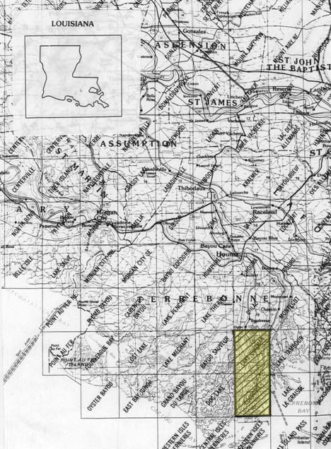
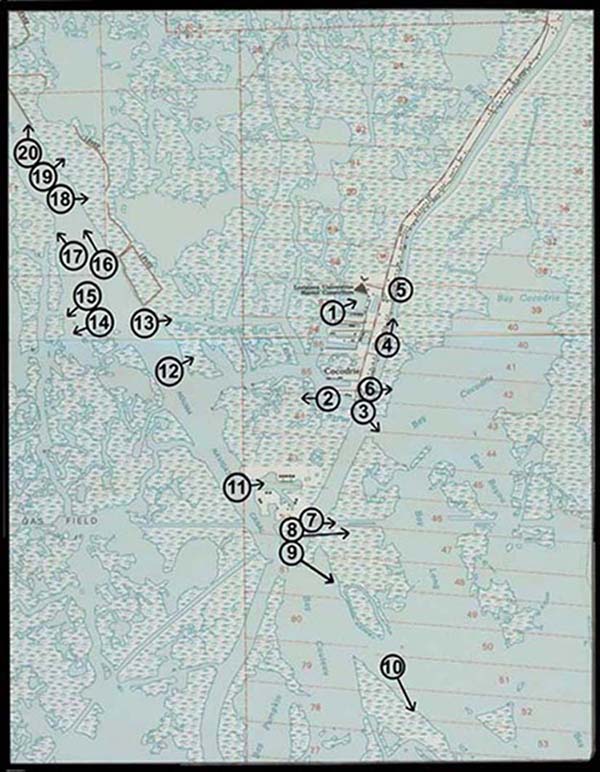
Figure 2: Cocodrie Photo Essay
Ground Photograph Locations With Line of Sight
Plate numbers correspond with circled numbers on the
reduced section (Cocodrie site) of the Lake Quitman and Cocodrie quadrangles. Arrows
indicate directions of line-of-sight.