Photographic Essay
of
Cape Hatteras
North Carolina
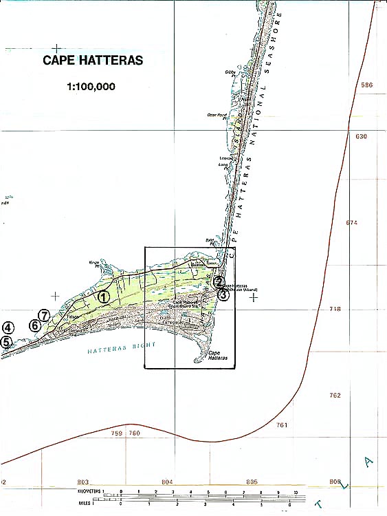
The focal point of the essay is the Cape Hatteras-Buxton Quadrangle (Figure 1). Photographs of selected wetland sites are from 35mm slides taken by the WETMAAP Development Team August 1998 (Figure 2).
The photographic essay is for use with a series of aerial photography, topographic maps, National Wetland Inventory maps, and selected materials on erosion, impacts of moving the Cape Hatteras Lighthouse, and wetland and upland habitat changes of North Carolina's Outer Banks..
The photographic essay has a dual purpose. First, the essay identifies some striking habitat changes within the area. Continued wave action and human interference along the National Seashore, especially the Cape Hatteras, results in erosion and adaptation and changes of seashore and inland habitats. Comparing ground level photography with maps and aerial photography aids in wetland interpretation.
Second, the essay shows representative examples of wetland categories -- open water, marsh, flats and beaches, wetland forests, agriculture/range, and urban areas -- that illustrate variations among wetland habitat types.
Cape Hatteras has experienced wetland loss and habitat change due to erosional wave activity and human activity, specifically through storms and urbanization. Specific habitats affected by changes over time include flats and beaches, saltwater marsh, wetland scrub-shrub, upland forested and upland scrub-shrub.
Figure 1: PROXIMAL LOCATION
The Cape Hatteras Study Site Cape Hatteras-Buxton Quadrangle
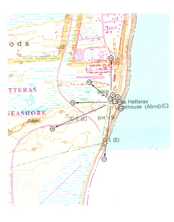
Figure 2: Cape Hatteras Photo Essay
Ground Photograph Locations With Line of Sight
Plate numbers correspond with circled numbers on the reduced section (Cape Hatteras site) of the Cape Hatteras quadrangle. Arrows indicate directions of line-of-sight.