Photographic Essay
of
Caddo Lake
Texas
The photographic essay focuses on an area of Caddo Lake, Texas Louisiana (Fig. 3.1). Photographs of selected wetlands locations are digital camera images taken by the WETMAAP Development Team in March 2008 (Fig. 3.2).
The photographic essay is for use with a series of aerial photographs, topographic maps, wetland and upland habitat maps, and selected materials that assist in the identification of changes of wetland habitats.
The site focus is on invasive aquatic species and changes in land use related to wetlands associated with a lake environment. The photographic essay identifies habitat changes of a portion of Caddo Lake area. Emphasis is on comparing ground level photography with maps and aerial and satellite imagery that aid in wetland interpretation for the area.
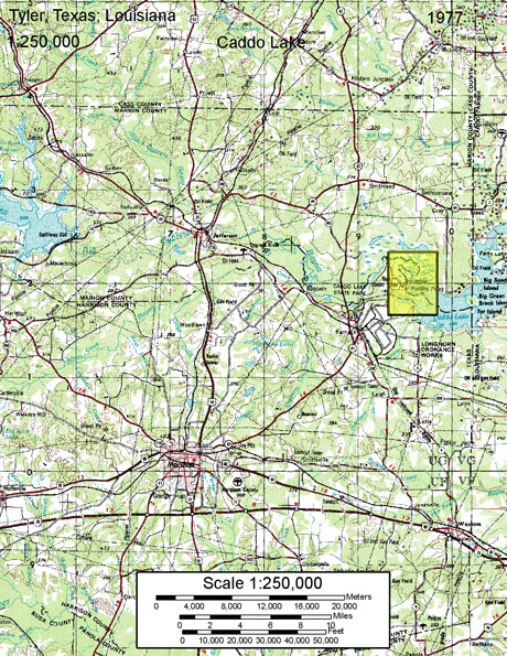
Figure 1: PROXIMAL LOCATION
The Caddo Lake Study Site Potter Point-Karnack Quadrangle
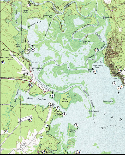
Figure 2: Caddo Lake Photo Essay
Ground Photograph Locations With Line of Sight
Plate numbers correspond with circled numbers on the reduced section (Caddo Lake site) of the Potters Point - Karnack quadrangle. Arrows indicate directions of line-of-sight.