Photographic Essay
of
Delcambre and Weeks Quadrangles
Avery and Weeks Islands, Louisiana
The focal point of
the essay is the Delcambre and Weeks Topographic Quadrangles (Figure 3.1).
Photographs of selected areas were taken by Jill Willis and Larry Handley in August 2000
(Figure 3.2).
The photographic
essay is for use with a series of aerial photography, topographic maps, wetland and upland
habitat maps, and selected materials that assist in the identification of changes of
wetland and upland habitats and human activities at Avery and Weeks Island.
The photographic
essay has a dual purpose. First, the essay identifies dramatic habitat changes
within the two areas. The change from freshwater to saltwater regimes, upland
forested areas to urban and industry development, the loss of wetland scrub shrub and the
changes in wetland forest. Comparing ground level photography with maps and aerial
photography aids in wetland and upland interpretation for the two areas.
Second, the essay
shows representative examples of wetland and upland habitat categories – salt open
water, fresh open water, flats and beaches, salt and fresh marsh, upland and wetland
forested, upland and wetland scrub shrub, urban and agriculture/range.
Avery and Weeks Islands are well known for their salt mining activities, which have been active through the past century. This area has had associated oil and gas development over the pass fifty years. Further development of industry and urbanization in association with natural secession has caused significant changes in wetland loss and habitat change over the past 32 years, which has been documented by aerial photography, habitat maps and land cover maps.
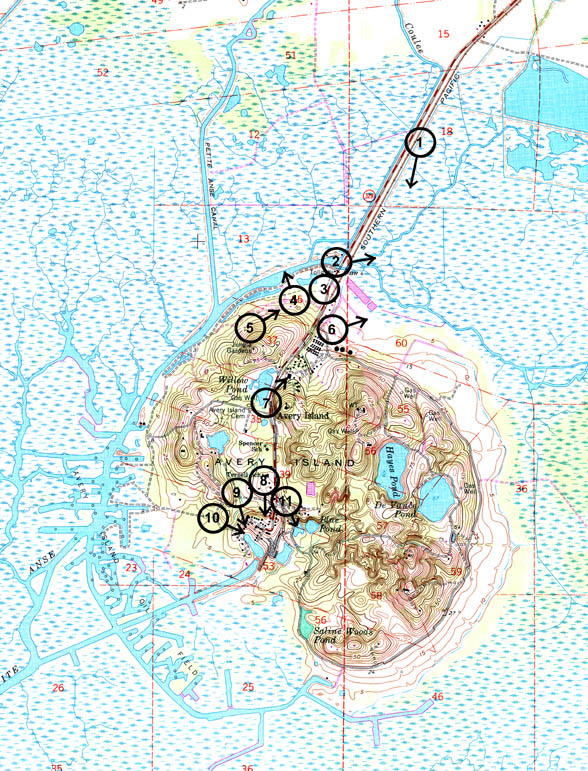
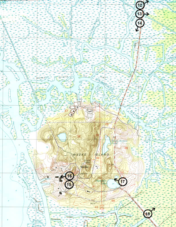
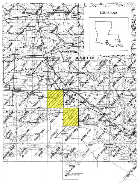
Figure 1: Proximal Location
Figure 1: Avery and Weeks Islands Photo Essay
Ground Photograph Locations With Line of Sight
Plate numbers correspond with circled numbers on the reduced section (Avery and Weeks Islands site) of the Delcambre and Weeks quadrangle. Arrows indicate directions of line-of-sight.